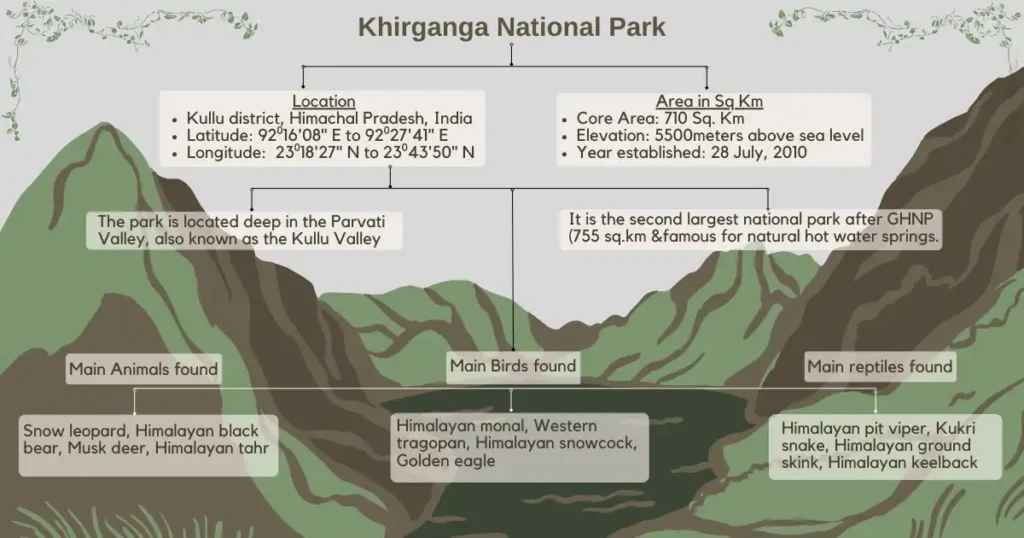
On July 28, 2010, Khirganga National Park was notified as a national park covering an area of 710 sq. km (270 sq. mi), extending to the contiguous northern boundary of the Great Himalayan National Park (GHNP) within the Parvati River catchment. It is the second largest national park after GHNP (755 sq. km / 292 sq. mi). It’s located in the Parvati Valley also known as Kullu Valley in the Kullu district of Himachal Pradesh. It was notified to protect the unique and significant biological diversity, conservation value and physical protection of the flora and fauna of the region as well as to promote ecotourism in the area. The park is managed by the Forest Department of Himachal Pradesh.
The Khirganga National Park is named after a small village called Khirganga which is located within the park and is famous for its hot springs. These natural hot water springs are believed to have healing properties. The park also has many other amazing things like tall grassy areas, alpine forests in the mountains and snowy mountain tops.
Khirganga National Park Map and Boundary
Covering 710 sq. km, Khirganga National Park’s boundaries are defined by its natural landscape, characterized by highly mountainous terrain, much like many areas in Himachal Pradesh. Situated in the Parvati Valley within the Kullu district of Himachal Pradesh, the park encompasses various landscapes ranging from alpine meadows to dense forests and rugged mountain terrain.
1. Northern Boundary:
The northern boundary of Khirganga National Park is bounded by Lahaul and Spiti district.
2. Eastern Boundary:
The eastern boundary of Khirganga National Park shares a transboundary connection with Pin Valley National Park, located in the Spiti Valley in the Lahaul and Spiti district.
3. Western Boundary:
The western boundary starts at Baskinag on Phangchi Dhar, follows the forest edge, touching points like Basunag. It then goes to Bakar Kiara Khol, down to the Parvati River near Nihara Thach. Along the river’s right side, it continues, crosses a ridge to join a stream, Tos Nal, and follows it to Kotlu Thach. Finally, it follows a popular trekking route from Kotlu Thach to Umga Thach, ending at Sara Umga Pass on the Kullu and Lahaul & Spiti district boundary.
4. Southern Boundary:
The southern boundary of Khirganga National Park is contiguous with the Great Himalayan National Park (GHNP) extending from east to west. Khirganga National Park was initially notified to enhance the biological, conservation value and physical protection in conjunction with GHNP.
Location, Area, Administration and Name
- District: Kullu
- State, Country/territory: Himachal Pradesh, India.
- Geographical coordinates: 32° 2′ 18″ North (32.038°) 77° 37′ 31″ East (77.625°).
- Area: 70,500 ha.
- Altitude: 1500-5810 meters above sea level (MSL).
- Name: Khirganga National Park.
- Administration: Forest Department, Himachal Pradesh.
 Khirganga National Park Map
History and Surroundings of Khirganga National Park
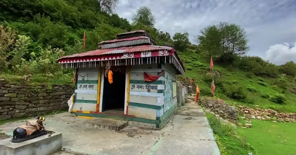
The surrounding region of Khirganga National Park has a long and interesting history. Many native tribes have lived here for thousands of years. In the past, it was an important place for trade and business. The park also has significant religious sites, such as temples dedicated to Hindu gods like Shiva and Vishnu.
There are other important tourist places nearby Khirganga National Park, such as Manikaran Sahib, Bhuntar, Tirthan Valley and Friendship Peak that are worth visiting.
 Khirganga National Park Photos : Shiva Temple
Geography, Geology and Climate of Khirganga National Park
1. Geography:
Khirganga National Park is situated in the middle part of the Himalayan region. This area is mostly comprised of sedimentary and metamorphic rocks, making it more susceptible to natural events like landslides and earthquakes. The elevation of the park is 5500 meters above mean sea level (MSL).
The park’s highest peak, Parvati Parbat (6632 m / 21759 ft), is Himachal Pradesh’s second most prominent mountain and one of India’s most prominent, rising over 2000 meters (6500 ft).
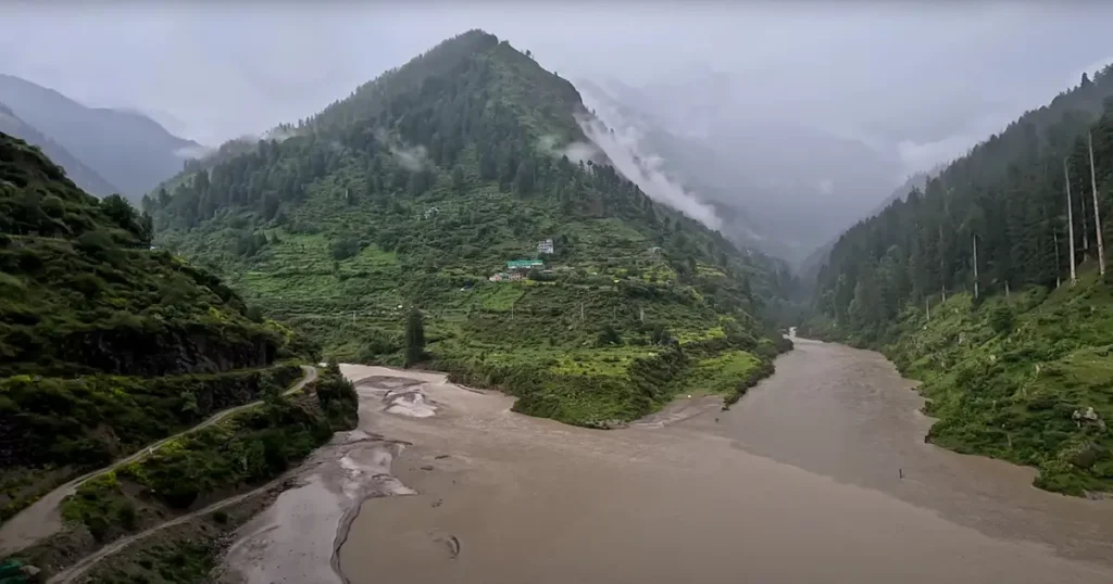
The Parvati River, which flows alongside the Kheerganga trekking trail, originates from Mantalai Lake. The park serves an important role as a watershed for the Parvati River, which is a major water source for the surrounding region. This makes the park a crucial water resources for the local communities.
2. Geological Features:
Khirganga National Park is in the Middle Himalayan zone, formed when the Indian and Eurasian tectonic plates collided about 50 million years ago, lifting the Himalayan range. In Himachal Pradesh, it’s crossed by two major tectonic units: the Greater Himalayan Crystalline Complex and Tethyan Himalayan Sequence.
The Greater Himalayan Crystalline Complex has metamorphic rocks like paragneiss, schist and migmatite. The Tethyan Himalayan Sequence has sedimentary and igneous rocks, mainly granite. Khirganga’s famous hot springs, believed to have healing properties, show the geothermal activity shaping the area.
3. Climate:
The weather in Khirganga National Park is significantly influenced by both its altitude and its location within the Himalayan range. Lower regions of the park typically have a subtropical climate, while higher elevations are marked by a colder alpine climate. Temperatures within the park can vary from 0°C to 30°C, depending on the season and altitude.
During the monsoon season, which lasts from June to September, there’s a lot of rainfall in the region. In the winter, from December to February, the higher parts of the park get snowfall.
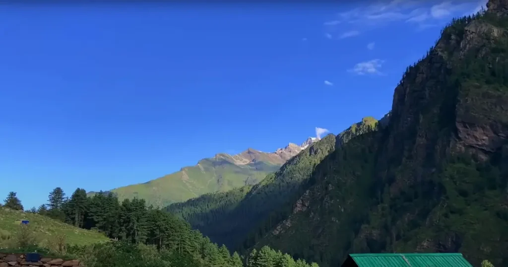
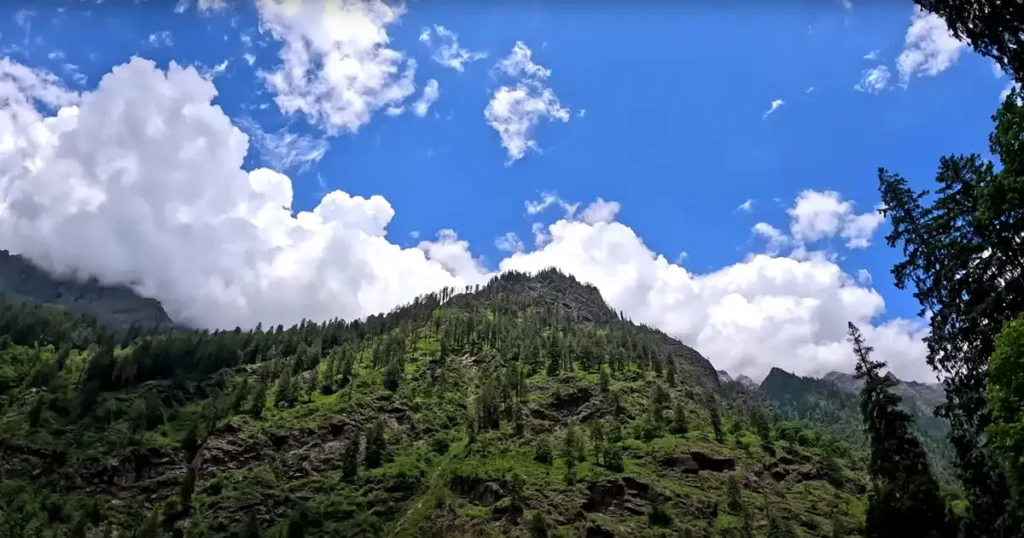 Khirganga National Park Photos: Mountain
Flora, Fauna, Avifauna and Reptiles in Khirganga National Park
1. Flora:
The park has many different types of forests, from sub-tropical to alpine. In the lower parts of the park, there are sub-tropical forests with broad-leaved trees like oak, maple and chestnut. At higher elevations, these forests change into coniferous forests with trees such as blue pine, deodar and spruce. Above where the trees stop growing, there are alpine meadows and shrubs. These trees and plants are really important for the animals living in the park because give them a place to live and food to eat.
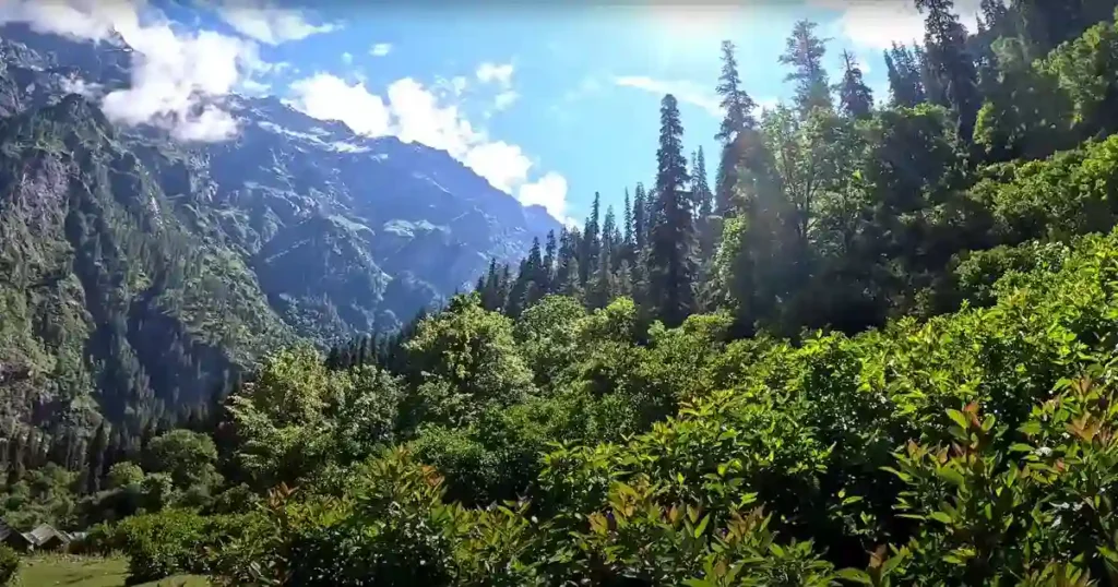 Khirganga National Park Photos: Forest
2. Fauna:
Khirganga National Park is home to a wide variety of wildlife, including some of the most well-known species of the Himalayan region. Some of the animals that can be spotted in the park include:
- Himalayan black bear: There are many Himalayan black bears living in the park.
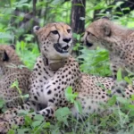
- Snow leopard: Snow leopards can be spotted in the wild at Khirganga National Park, which is rare in India.
- Himalayan tahr: The park is home to a population of Himalayan tahr, which is a species of wild goat found in the Himalayas.
- Musk deer: Musk deer, which are known for their distinctive scent, live in the forests of the park.
- Barking deer: The park is inhabited by barking deer, which are a type of small deer typically found in South and Southeast Asia.
- Yellow-throated marten: The yellow-throated marten is a small carnivorous mammal found in the Himalayan region and also in the park.
- Himalayan Weasel: The Himalayan Weasel is a small carnivorous mammal that inhabits the Himalayan region.
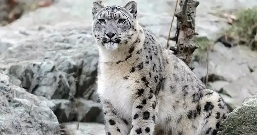 Khirganga National Park Photos : Snow Leopard
3. Avifauna:
Khirganga National Park is a great place for birdwatchers, with more than 200 bird species recorded there. Some of the birds you might see in the park include:
- Western tragopan: This is a brightly colored pheasant that lives in the western Himalayas.
- Himalayan monal: This bird is the official state bird of Himachal Pradesh and one of the most famous birds of the Himalayas and can be spotted in Khirganga National Park.
- Golden eagle: This is a big bird of prey that lives in the Himalayas.
- Himalayan snowcock: The Himalayan snowcock is a big game bird found in the high-altitude regions of the Himalayas.
- Himalayan griffon: The Himalayan griffon is a big vulture that inhabits the Himalayas.
- Himalayan bulbul: This is a tiny perching bird that lives in the Himalayas.
- Koklass pheasant: The Koklass pheasant is a big bird found in the western Himalayas.
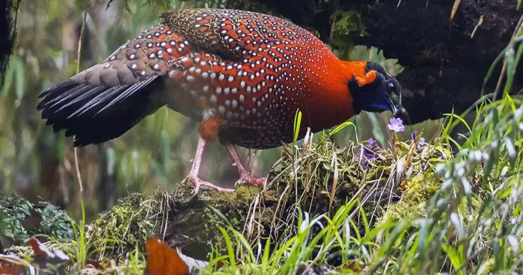 Khirganga National Park Photos : Western tragopan
4. Reptiles:
Khirganga National Park is home to a variety of reptiles, including some rare and endangered species. Some of the reptiles that can be spotted in the park include:
- Himalayan pit viper: Himalayan pit viper is a venomous snake found in the park.
- Himalayan ground skink: The Himalayan ground skink is a small lizard found in the Himalayan region.
- Kukri snake: Kukri snake is a non-venomous snake found in the Khirganga National Park.
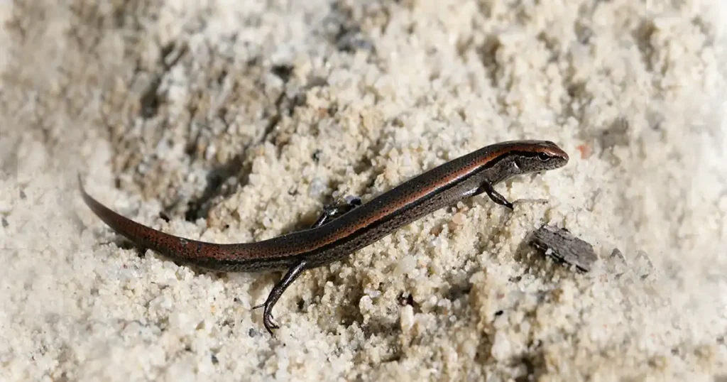 Khirganga National Park Photos : Himalayan ground skink
Trekking in Khirganga National Park
Spelled “Kheer Ganga,” “Khir Ganga,” or “Kheerganga,” this small village is a popular trekking destination located in Parvati Valley, Khirganga National Park, Himachal Pradesh, India. It is a high-altitude alpine meadow situated near the pilgrimage town of Manikaran in Himachal Pradesh. Kheerganga is famous for its hot water springs, scenic landscapes and the Parvati River. Trekking to Kheerganga is a favorite among trekkers and adventure enthusiasts, typically starting from the village of Barshaini.
1. Travel Information and Trekking Basics:
Barshaini village has good road access with Kullu Airport being the nearest airport and Chandigarh the closest railway station. The drive from Delhi to Barshaini typically takes around 10 to 12 hours. Khirganga is situated at an elevation of approximately 10,050 feet above mean sea level (MSL), and heavy snowfall occurs in winter.
To trek to Kheerganga, first, you need to travel to Kasol by bus or taxi and then proceed to Barshaini, which is 12 kilometers away from Kasol and serves as the base point for Kheer Ganga. Barshaini village is situated on the same road as Tosh, just 3 kilometers further. You can hire a private taxi or take a bus from Kasol; the bus fare is Rs. 50, and the taxi fare is Rs. 1000. Once you reach Barshaini, there are shops where lockers are available, allowing you to store your extra luggage securely.
2. Trekking Routes and Camping Choices:
There is camping available at the top of Kheerganga and booking can also be done at the shops below in Barshaini. However, it is better to choose and book after reaching the top by inspecting the campsites. There are two routes for this trek: one goes up via the Kalga route and returns via the Rudra Nag route. While there is another route from the Tosh side, generally, tourists staying in Tosh use this route. One advantage of the Kalga route is that dense trees cover almost the entire path, providing protection from both sunlight and tanning.
Tosh, this route is also very beautiful, but there are no trees on this route, so even if it is sunny, it will be hot. It’s a good idea to carry a raincoat because it can rain at any time in the mountains.
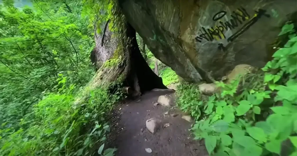
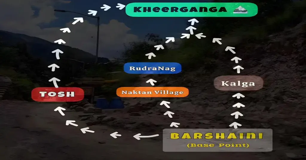 Khirganga National Park Photos : Trekking Routes
3. Trekking Tips:
The Khirganga trek is easy, but it is 14 kilometers long, so it will take four to five hours to reach the top. If you want to stay at the top, then start this trek before 12:00 o’clock so that you can reach the top by 4:00 or 5:00 in the evening. But if your intention is to come back down on the same day, then you will have to start the trek early in the morning.
This is one of the most famous treks in Parvati Valley, hence there are a lot of crowds here. On weekends, there is also a traffic jam of humans, so it is better to plan this trek on a weekday.
4. Panoramic Beauty:
This trek is very beautiful and there is no dearth of views here. There is not much climbing in the trek; even if there are some points where one must climb the mountain, it is not that difficult.
During the trek, you will also find three or four waterfalls, which are very beautiful and will compel you to stop. You can comfortably complete the trail without a guide; it is possible to navigate the route alone, as you will meet many people during the trek.
There are cafes at every short distance, so there is no problem in eating and drinking.
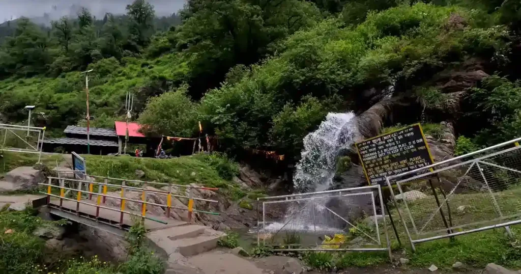
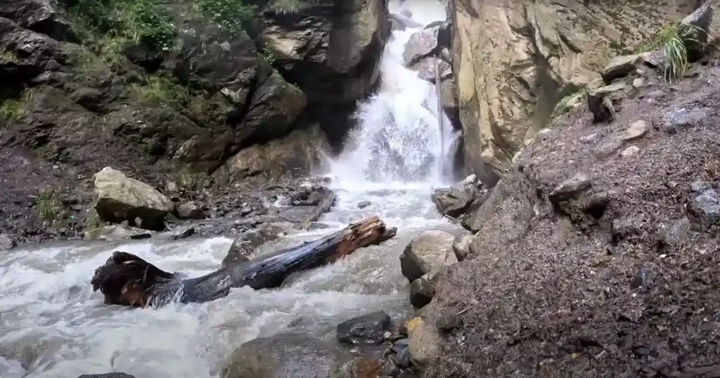 Khirganga National Park Photos : Waterfall
5. Revitalizing Soak: Kheerganga’s Hot Spring Bath:
After reaching the top of Kheerganga, one can bathe in the natural hot water spring, which removes all the fatigue from the trek. Kheerganga is also very famous for its natural hot water spring. Earlier this source of hot water was in Parvati Kund but now this pond is kept empty due to some religious reason. There is also a temple of Shiva on top of Kheerganga. Along with the temple, there is a source of hot water from the hot water spring. The views from Kheerganga are so wonderful that one can sit here for a long time without doing anything and just immerse oneself in nature.
6. Mythology of Parvati Kund:
There is mythology associated with Parvati Kund in the Parvati Valley. According to Hindu mythology, it is believed that during during the time of Gods, there was a river of Kheer (a sweet rice pudding) flowing in the Parvati Valley. However, when the Kali Yuga (the current age according to Hindu cosmology) ended, Lord Shiva requested Lord Parshuram, an avatar of the god Vishnu, to transform the river of Kheer into a regular water river.
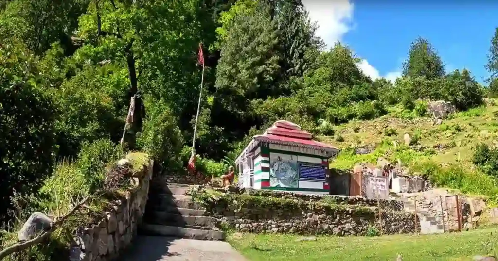 Khirganga National Park Photos : Shiva Temple at the top of Parvati Khund
7. Camping at Kheerganga:
After enjoying a hot spring dip in Kheerganga, one can consider camping as there are available options for camping in the area. Camps are scattered everywhere, offering various types of accommodations that include dinner and breakfast. Facilities typically include common areas, shared washrooms, free WiFi and electricity. Some camps also organize bonfires at night, with rates ranging up to ₹700. However, one issue to note is the lack of mobile network coverage in the area.
Kheerganga is the last inhabited place situated on the Mantalai and Pin Parbati Valley trail. It serves as the connecting pass in Kullu District near Parvati Pass, linking Parvati Valley with Lahaul Spiti District.
 Khirganga National Park Photos : View from Kheerganga Top
8. Kheerganga Trek: Routes, Scenery, Culture and Trek’s Conclusion:
After camping in Kheerganga, when returning, one can choose to take the Rudra Nag route for a different experience. However, for the first 3 kilometers, the road to both Kalga and Rudra Nag is the same. After this point, there is a junction with many cafes, where both roads separate. This route is also beautiful, but it lacks trees, so it can be hot even on sunny days.
Along this route, there are two different waterfalls. The Parvati River is also visible along the way. Additionally, there is the famous Rudra Nag Temple. A little ahead of Rudra Nag Temple is Naktan Village, where the trekking of Kheerganga comes to an end. Here, you can take a break and experience village life. The traditional culture of Naktan is still well preserved today. After crossing Naktan, just five minutes later, one can witness the powerful and aggressive flow of the Parvati River.
Although one might think that it would take only half the time to descend and comfortably reach Bashaini in two hours, it actually took four and a half hours to descend.
 Khirganga National Park Photos : Rudra Nag Temple
Best time to visit Khirganga National Park
The ideal time to go to Khirganga National Park is from September to November and April to June. During these months, the weather is pleasant and the skies are clear. It’s easier to see the different animals and beautiful scenery in the park during this time.
During the summer months from April to June, visiting the park is most popular because the weather is mild and there are lots of plants and animals to see. However, it’s not a good idea to visit during the monsoon season from July to August because the trails can become slippery and dangerous. In the winter months from December to February, it’s also not ideal to visit the park, as heavy snowfall occurs during these months, making some paths inaccessible
 Khirganga National Park Photos : Trekking Routes
How to Reach Khirganga National Park?
Khirgangan National Park is one of the most famous destinations for tourists visiting Himachal Pradesh. Visitors have various transportation options available to reach the destination, including air, rail, or road travel.
By Air:
Kullu has its own airport located in Bhuntar. The airport operates numerous flights from Delhi and Chandigarh to Kullu. Upon arriving at the airport, visitors can choose to take a taxi or bus to reach their destination. The distance from Bhuntar to Barshaini is 35.7 km and the drive takes approximately 1 hour and 43 minutes.
By Road:
Getting to Khirganga National Park is easy because of its well-connected roads linking it to Himachal Pradesh and other cities through Kullu. Luxury and affordable bus services make travel smooth, even from Delhi to Kullu. Taking a bus is a good choice if you’re coming from Delhi or Chandigarh. You can also choose a taxi or drive your own car. The distance from Kullu to Barshaini is 48.2 km, and the drive takes about 1 hour and 56 minutes.
By Train:
There is no direct train connectivity to Khirganga National Park. The nearest railway station to the park is Joginder Nagar Railway Station, which is 120 km away from Kullu. However, once you reach the railway station, you can hire a bus or a taxi.
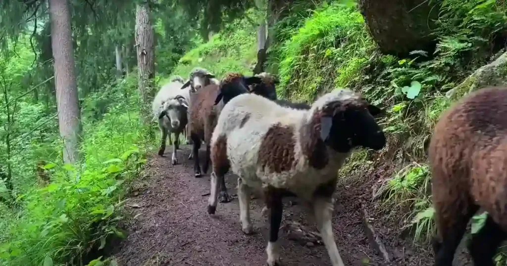 Khirganga National Park Photos : Shepherds Grazing Goats
Where to stay
In Kasol, there are forest rest houses, inspection huts and many hotels. If you are planning for a trek, first, you have to come to Kasol. Once you’ve reached Kasol from a distance, spend the first two-three days exploring Kasol and its surrounding places comfortably. Some places to visit include Manikaran Sahib Gurudwara, Grahan Village, Challal Village, Katagala and many more. When planning to trek to Khirganga, wake up early in the morning, take a bus or taxi and reach Barshaini early. Barshaini is 12 km away from Kasol and serves as the base point for Kheer Ganga trek.
Khirganga National Park Location
Conclusion:
Khirganga National Park, established on July 28, 2010, is situated at an altitude of 5500 meters above sea level in the Kullu district of Himachal Pradesh. It is a unique tourist destination offering a combination of trekking to Kheerganga, exploration of diverse flora and fauna, scenic beauty, the opportunity to bathe in natural hot water springs and the enchanting sight of waterfalls. Bathing in the natural hot water springs at the top of Kheerganga removes all the fatigue from the trek.
During the trek to Khirganga, you may encounter many shepherds taking their goats to graze on the nutritious grass found at high passes. In the Parvati Valley, weekends are crowded with human traffic jams, so it’s best to trek on weekdays. You can navigate the trail alone since you’ll meet many people. Cafes are available at short intervals for food and drinks, so there’s no worry.
FAQ
a) What is Khirganga National Park famous for?
Khirganga National Park is famous for its natural hot water springs. These hot springs, for which the village is known, are believed to have healing properties. The park is also renowned for other amazing features like tall grassy areas, alpine forests in the mountains, snowy mountain tops, and trekking to Kheerganga. Visitors can bathe in the natural hot water springs, which removes all fatigue from the trek.
b) Which river flows through Khirganga National Park?
The Parvati River flows through Khirganga National Park, originating from Mantalai Lake, which is located in the Parvati Valley of the Kullu District in Himachal Pradesh. The lake is situated at an altitude of 13,580 feet (approximately 4,139 meters above sea level).
c) Khirganga National Park is located in which state?
Khirganga National Park is located in Kullu District of Northern India State of Himachal Pradesh covering an area of 710 sq. kms (270 sq. mi).
d) The relevance of Khirganga National Park in UPSC examinations:
Khirganga National Park was notified as a national park on July 28, 2010, covering an area of 710 square kilometers (270 sq. mi). It is the second largest national park after Great Himalayan National Park (755 sq. km / 292 sq. mi) and located in the Parvati Valley, also called Kullu Valley, in Himachal Pradesh’s Kullu district. The park is famous for its hot spring water and the trek to Kheerganga, where a temple of Shiva atop Kheerganga.
You May Also Like
- Inderkilla National Park
- Murlen National Park
- Phawngpui National Park
- Nameri National Park
- Raimona National Park
4 thoughts on “Khirganga National Park”